

- cross-posted to:
- map_enthusiasts@sopuli.xyz
- cross-posted to:
- map_enthusiasts@sopuli.xyz
More info here: https://exhibits.stanford.edu/ruderman/catalog/mz230kn1495
You must log in or register to comment.
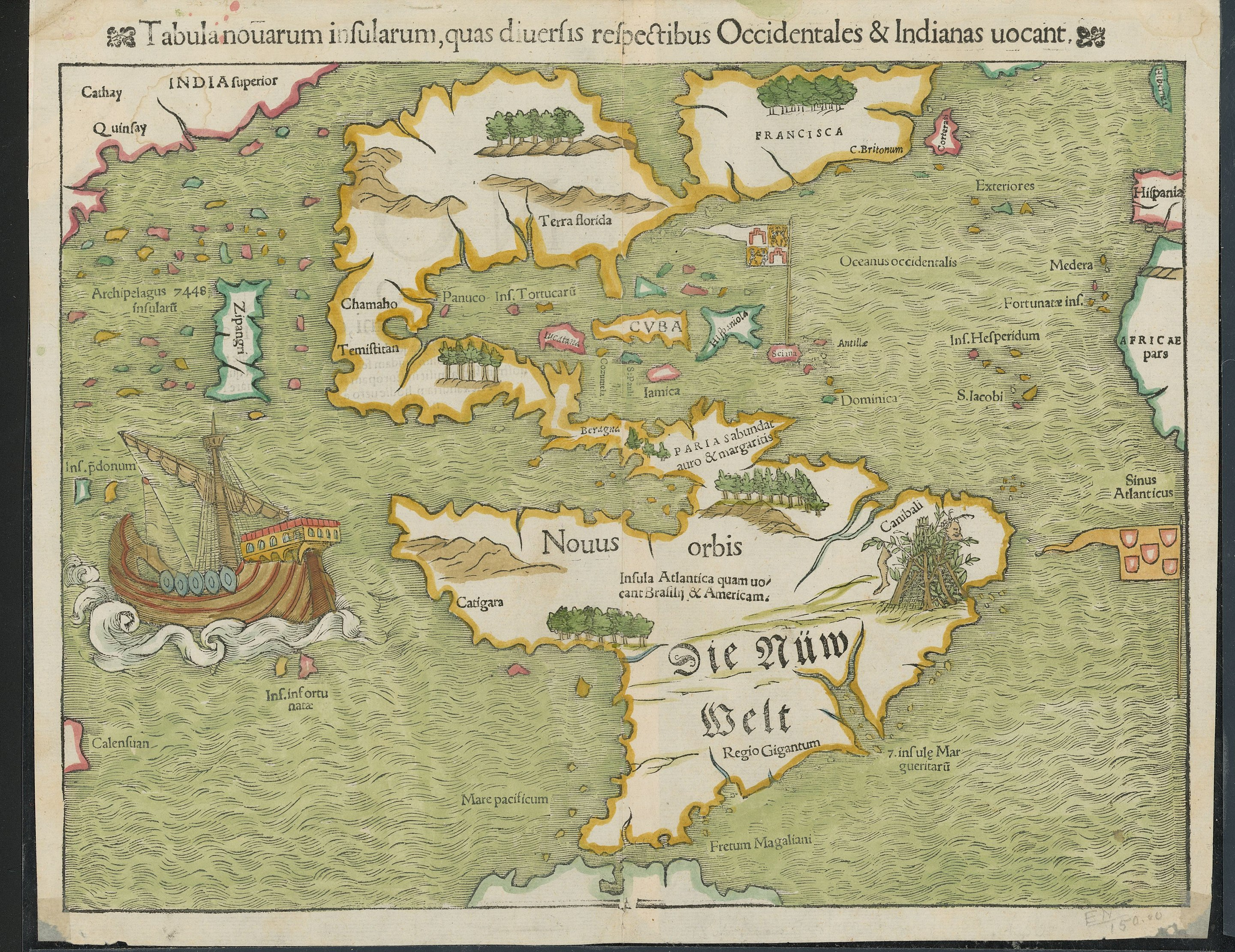
I absolutely love wildly inaccurate old maps. They have so much charm.
Anyone know what Zipangri is? Could that be Baja California, or what?
Edit: Japan. Is apparently just off the coast of Mexico
I really really want to find a good book or website showing the extended evolution of maps of the world or specific areas. This stuff fascinates me.
I’ve found a few minor ones over the years, but never a good one.
The water is colored green. Took my mind a bit of time to realize the land is water and the water is land
Probably azurite paint aging. Turns green (Edit: forgot to mention because it turns into malachite) over time and was super common Europe.
It’s why a ton of Renaissance art has greens where you’d expect blues
Pretty good map for the 16th century anyhow, except India being where Russia would be
“India” did not mean then what it does now.
Man what a shit map, they are horrible at cartography /s
This dumbass didn’t even know the Maps app is free.


